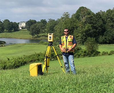


Land Surveying
Land surveying forms the cornerstone of what we do. After all, property is a valuable resource and we want to help you make the most of it! Whether you need a survey for a large tract or just want to know where your lines are for landscaping, our team can assist with projects of any size.
Mark Property Lines
This service is a great option when you need to clarify your property boundaries for fence installation, landscaping, or to verify a potential encroachment.
Boundary Survey (Retracement)
This service is a great option if you would like to know the actual acreage of your property, have a known property dispute, or plan to build.
Property Division, Combination, Reconfiguration, and Land Swap
Our team will complete initial fieldwork to verify the acreage of your property,
Field Run Topographic Data
Service includes field location of contours on the property. This is the highest quality topographic data available, providing the most up to date and accurate contour data.
ALTA and NSPS
Unlike a standard boundary survey, this survey conforms to a higher level of national surveying standards and is typically requested when purchasing commercial property.
Large Tract Survey
Our team specializes in the project management and production of large tract surveys and is well versed in the care and attention to detail required for this type of project.
Tree Survey
Service includes location of specific trees on the property. Constraints can be based on a specific area, diameter, specimen status, or hardwoods.
Alcohol Survey
If your business is seeking to obtain a permit for alcoholic beverages, our experienced staff can expedite the process for you and meet all requirements established by regulating agency.
Elevation Certificates
Obtaining an accurate survey can help evaluate the actual flood risk to your property. To determine your property’s flood risk,
Design File
Preparation of a CAD file deliverable of all survey data (boundary, existing conditions, and topographic and/or tree data) for future design use.
Legal Description
Preparation of a written or “long legal” description of the property using metes and bounds only.