

When it comes to understanding your property boundaries, it’s crucial to know that there is no substitute for a line marking or boundary survey performed by a professional land surveyor. All maps are not created equal and public databases, like qPublic, excel in their intended purpose, but have limitations when it comes to accurately displaying and identifying property boundaries.
The Limitations of Mapping Apps
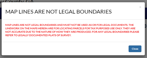
The data on qPublic is used to track property sales data to support county tax assessor evaluations. They provide a valuable resource for researching historical sales or property tax data for a parcel and the information is typically updated once a year, meaning that any changes to property boundaries made throughout the year may not be reflected until the following calendar year. Inaccuracies in these land parcel maps can lead to unintentional trespassing on someone else's land, disputes with neighbors, and costly fees for both parties. To avoid these issues, a boundary survey conducted by a professional is recommended and often essential.
Mapping apps, like onX Hunt or HuntStand, are popular among landowners, hunters, and outdoor enthusiasts because they offer easy access to parcel maps and usually provide aerial and topographic data. These apps pull parcel data from public sources, like qPublic, often creating confusion among homeowners and potentially compounding inaccuracies. While public databases and apps can be useful, they should never be used as a definitive source for legal boundary information.
Another factor to consider is that the county representatives who maintain qPublic and similar databases are not surveyors. They rely on historical data and maps to ensure the accuracy of the information they provide, but they may not always have the technical expertise required to handle complex boundary issues. This is another reason why a boundary survey is so important.
The Importance of a Boundary Survey
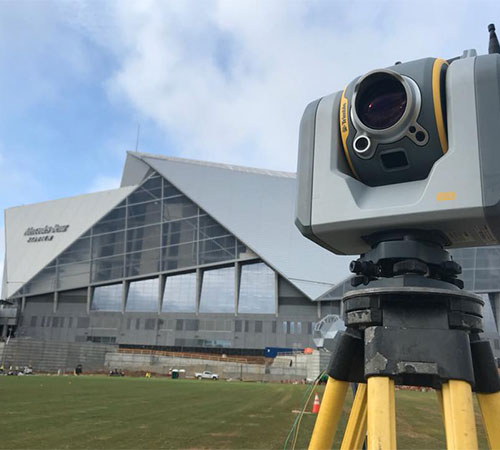
A boundary survey is the only reliable way to determine the exact legal boundaries of your property. Unlike mapping apps, which provide a generalized representation, a boundary survey involves a detailed and precise examination of your property’s boundaries by a licensed surveyor. Our surveyors will identify physical markers, examine historical records, and use the latest equipment and technology to locate, confirm, and establish your property boundaries.
Getting a survey is particularly important if you plan to build a fence, construct a building, buy or sell property. It ensures that you are fully aware of where your property begins and ends, and that all structures are within your boundaries, preventing any potential legal issues down the road.
Trust DES Experts for Accurate Boundary Determinations
While mapping apps and land parcel maps are convenient tools, they should not be relied upon for legal boundary determinations. A boundary survey conducted by a licensed professional is the only way to ensure that your property boundaries are accurate. If you have any questions about your property lines or are searching for “land surveyor near me”, reach out to DES today!