

Drone technology has completely restructured the way land surveying, civil engineering, and construction projects are managed. At Davis Engineering and Surveying (DES), we’ve embraced these advancements to provide our clients with more precise, efficient, and cost-effective solutions. Two of the most impactful services in our survey toolbox are drone LiDAR data and aerial imagery, which have changed the way we collect and analyze data.
What is Drone LiDAR?
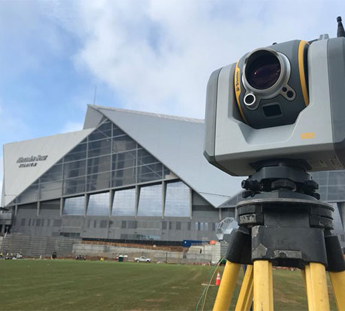
Drone LiDAR (Light Detection and Ranging) is a remote sensing method that uses laser pulses to generate highly accurate, 3D models of the Earth's surface. By mounting LiDAR systems on drones, DES can reach hard-to-access areas, capture precise elevation data, and create detailed topographic maps. This technology is a game-changer for projects requiring extreme accuracy, like grading plans, slope analysis, and floodplain assessments.
Unlike traditional survey methods, drone LiDAR can "see" through vegetation, making it ideal for heavily wooded/forested sites. This ability ensures that no detail is missed, which is crucial for civil engineering design and construction planning. The ability to map through tree canopies allows DES to provide our clients with a clear view of the ground’s natural state without the need for extensive clearing.
The Power of Aerial Imagery
While LiDAR focuses on elevation data, aerial imagery offers a high-resolution, bird’s-eye view of a project site. Drones equipped with high-quality cameras capture images from multiple angles, giving clients a clear visual understanding of their project’s progress. Aerial imagery provides real-time perspectives that are invaluable for project stakeholders, contractors, and developers.
At DES, we use aerial imagery to support boundary surveys, track construction progress, and perform site inspections. Instead of relying on outdated satellite imagery or incomplete maps, our drones capture up-to-date, high-resolution visuals. This approach enhances decision-making, allowing project managers to spot potential issues early and make adjustments in real time.
Benefits of Drone LiDAR and Aerial Imagery
- Unmatched Accuracy: Drone LiDAR delivers precise elevation data, while aerial imagery provides high-resolution visuals. Together, they offer a comprehensive view of the project site.
- Faster Turnaround: Traditional survey methods can be time-consuming, especially in dense vegetation or rough terrain. Drone technology speeds up data collection, allowing projects to move forward without delays.
- Cost-Effective Solutions: Drones reduce the need for large field crews and heavy equipment. The efficiency of drone LiDAR and aerial imagery lowers project costs while maintaining top-level accuracy.
- Increased Safety: Drones reduce the need for surveyors to work in hazardous areas, like steep slopes or high-traffic construction zones. Safer operations mean a safer project site for everyone involved.
Real-World Applications
At DES, our clients benefit from the practical use of drone technology across various industries. For land developers, aerial imagery helps with site selection and planning. For environmental consultants, drone LiDAR captures precise terrain models that inform floodplain studies and drainage analysis. When performing a construction layout, we rely heavily on aerial imagery to monitor progress and document changes in real time.
One of our recent projects involved mapping a forested site for a large-scale development. With drone LiDAR, we produced a detailed topographic map without disturbing the natural landscape. The aerial imagery captured during the project gave stakeholders a clear view of the site's existing conditions, leading to better planning and design decisions.
Why Choose DES for Drone Services?
With years of experience and a commitment to cutting-edge technology, DES is a leader in drone surveying. Our team’s expertise with drone LiDAR and aerial imagery ensures that we deliver data that’s accurate, actionable, and cost-effective. From site feasibility studies to construction oversight, we’re proud to provide clients with forward-thinking solutions that drive project success.
To learn more about our drone services, visit our drone services page. See how drone LiDAR and aerial imagery can bring new levels of precision and efficiency to your next project.